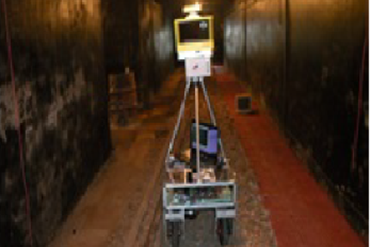
Lack of accurate map in underground mines poses a serious threat to the safety of both public and mine workers. In July 2002, nine miners in the Quecreek Mine in Sommerset, Pennsylvania were trapped in underground for three and half days after accidentally drilling into a nearby abandoned mine. A subsequent investigation led to the conclusion that the cause of the accident could be attributed to inaccurate maps. Since the abandoned underground mines create hazardous environmental conditions and difficult access routes, mapping of such mines becomes a grave concern. In this regard, mapping of abandoned underground mines through a robotic exploration appears to be a viable alternative which may avoid the necessity of human beings to be exposed to the hazardous mining environment. Autonomous mobile robots adopting simultaneous localization and mapping (SLAM) technology might be a possible approach for acquiring accurate 3D maps of underground mines in near future. Building a map, localizing within the map, and planning using the map are some of the fundamental problems for researchers in mobile robotics. Every mobile robotic system must incorporate some type of solution to all the three problems. Localization and mapping in underground environments are very challenging tasks. In this study a laboratory based prototype mine robot was used for 3D underground mapping purpose. Its mapping capability was tested for 3D map generation in two cases, namely, (1) in the test mining gallery and (2) in one real underground mine gallery.
The occupancy grid map based obstacle detection and avoidance algorithm, RRT and basic value iteration algorithm for path planning, EKF based pose estimation algorithm, and cache K-D Tree based searching algorithms for use in 3D ICP based scan matching algorithm were implemented for localization and mapping tasks. Prior to implementation of these algorithms and the different sensors in test cases, the outputs of each of the individual sensors and algorithms were analysed on different experimental conditions appropriate for each specific case. For example, the performance of occupancy grid based obstacle detection algorithm were verified by simulating different cluttered scenarios. The capability of the EKF based pose estimation algorithm was also examined on three different surface terrains, namely smooth surface (indoor condition), moderately smooth surface (normal surface road condition) and rough surface (test mining gallery condition).
Similar to the testing of algorithms, suitable experiments were designed to test the capabilities and limitations of the different sensors, namely, shaft encoder, IMU, 2D laser range finder and 3D laser scanner that were used in this study
The accuracy of generated 3D map was checked at selected cross sections in terms of the areas obtained from these generated maps with those obtained from the conventional survey instruments like total stations.
The test cases indicated that the differences in the areas between the robot generated maps and those generated using conventional survey were 0.02m2 for test mining gallery and 0.51 m2 for real underground mining gallery. The apparent degradation in accuracy for real mining gallery might be attributed to the uneven rough wall surfaces of the underground gallery